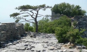
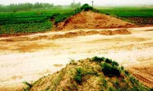
The northern segment of the Great Wall of China was built not to block invading armies but rather to monitor civilian movement, an Israeli archaeologist said Tuesday.
周二,一位以色列考古学家说,中国长城北段的建造并不是为了阻挡军队入侵,而是为了监视平民行动。
When researchers fully mapped the Great Wall's 740-kilometre (460-mile) Northern Line for the first time, their findings challenged previous assumptions.
研究人员首次绘制了长城北段总长740千米(460英里)的地图,他们的发现与之前的假设不符。
"Prior to our research, most people thought the wall's purpose was to stop Genghis Khan's army," said Gideon Shelach-Lavi from Jerusalem's Hebrew University, who led the two-year study.
耶路撒冷希伯来大学的Gideon Shelach-Lavi领导进行了这项持续两年的研究,他说:“在我们的研究之前,大多数人以为建造城墙的目的是要阻挡成吉思汗的军队。”
But the Northern Line, lying mostly in Mongolia, winds through valleys, is relatively low in height and close to paths, pointing to non-military functions.
但北段主要位于蒙古,穿越山谷,高度相对较低,靠近小路,这一切都指向非军事功能。
"Our conclusion is that it was more about monitoring or blocking the movement of people and livestock, maybe to tax them," Shelach-Lavi said.
Shelach-Lavi说:“我们的结论是,北段更多地是用来监视或阻碍人和牲畜的移动的,可能是为了征税。”
He suggested people may have been seeking warmer southern pastures during a medieval cold spell.
他表示,人们可能是在中世纪的寒冷时期想要去寻找南方更温暖的牧场。
Construction of the Great Wall, which is split into sections that in total stretch for thousands of kilometres, first began in the third century BC and continued for centuries.
长城的建造分几段,总长数千千米,初建于公元前3世纪,工程持续了数百年。
The Northern Line, also known as "Genghis Khan's Wall" in reference to the legendary Mongolian conqueror, was built between the 11th and 13th centuries with pounded earth and dotted with 72 structures in small clusters.
北段也被称为“成吉思汗长城”,和这位蒙古族传奇征服者有关。这段长城建于11-13世纪,在夯土上散落着72个小型建筑群。
Shelach-Lavi and his team of Israeli, Mongolian and American researchers used drones, high-resolution satellite images and traditional archaeological tools to map out the wall and find artefacts that helped pin down dates.
Shelach-Lavi和以色列、蒙古以及美国研究员组成的团队利用无人机、高分辨率卫星图像和传统考古工具绘制出了城墙地图,还找到了帮助他们确定日期的手工艺品。
According to Shelach-Lavi, whose findings from the ongoing study were published in the journal Antiquity, the Northern Line has been largely overlooked by contemporary scientists.
Shelach-Lavi通过正在进行的这项研究所获得的研究成果发表在了《Antiquity》期刊上,他说长城北段在很大程度上被当代科学家忽视了。


